East Newark

NJ
Average Sales Price
$692,333
Median Sales Price
$732,500
Population
2,453
Total Listings
6
East Newark NJ – Hyper-Local Block

NJ's 2nd Smallest Municipality: 0.10 Sq Mi Land. 2,500 Residents.
Hudson County. Passaic River. Established 1895. 16 Feet Elevation.

Everything you need to know before making East Newark, NJ home.

Clifton is one of New Jersey's largest and most genuinely diverse cities — 11.4 square miles, population approximately 90,000, incorporated as a city in Passaic County at 131 feet elevation, 12 miles from Midtown Manhattan. The city is structured as a dense patchwork of distinct neighborhoods — Botany Village, Richfield, Styertowne, Athenia, Montclair Heights, Allwood, and Lakeview — each with its own commercial character and residential identity that reflects successive waves of immigrant settlement from the early 20th century through today. 35.1% of residents were born outside the United States, representing one of Passaic County's most international communities, with significant Latin American, Middle Eastern, South Asian, and Eastern European populations alongside the established Italian-American and Polish-American communities that shaped the city's mid-century character. City-Data: $86,591 median household income (2024); 59.6% homeownership; 28.3-minute average commute; 27% of workers live and work in the city.

The school district — Clifton Public Schools, PreK-12, 20 schools, approximately 10,514 students, 12.1:1 ratio, DFG CD — is one of New Jersey's larger unified districts. Clifton High School (333 Colfax Avenue, Mustangs, Maroon and Gray, established 1906, 3,150 students 2024-25, 14.0:1, Big North Conference, rival: Passaic High School) is the third-largest high school in New Jersey. The market: Redfin $617,500 (+0.4%, November 2025, 63-day DOM, 104.7% sale-to-list); Movoto $599K list (May 2026, 23-day DOM); Zillow ZHVI $514,371 (+6.2%); Houzeo $585,000 (+0.02% YoY). True SFH range approximately $500K-$750K; condos approximately $300K-$450K. The 2024 average tax bill is approximately $10,001 on a 2.1% effective rate. The city sits at the intersection of Route 3, Route 46, I-80, I-280, and the Garden State Parkway — arguably the most highway-accessible residential city of its size in northern New Jersey — with NJ Transit bus service (Routes 190, 191, 192, 74, 75) providing Port Authority access approximately 35-50 minutes.

🛣️
Route 3, Route 46, I-80, GSP — All In-City Most highway-accessible residential city in northern NJ
🌍
35.1% Foreign-Born — Passaic County's Most Diverse City Latin American · Middle Eastern · South Asian · Eastern European
🏫
Clifton HS — 3rd Largest in NJ · DFG CD · 14:1 3,150 students · Mustangs · est. 1906 · Big North Conference
🏡
SFH ~$500K-$750K · Condos ~$300K-$450K Redfin $617K · Movoto $599K · Zillow $514K · 23-day DOM
💰
~$10,001 Avg Tax Bill · 2.1% Effective Rate City-Data 2024 · $86,591 median HH income · 59.6% homeown.
🏘️
7 Distinct Neighborhoods — Each With Its Own Identity Botany Village · Richfield · Styertowne · Athenia · Allwood · more

Getting There From Here

Clifton sits at the convergence of Route 3, Route 46, I-80, I-280, and the Garden State Parkway — the most highway-accessible residential city of its size in northern New Jersey — with NJ Transit bus service to Port Authority and 12 miles to Midtown Manhattan.

NYC Port Authority (Bus)
NJ Transit Routes 190/191/192 · Route 3 corridor
~35-50
minutes by bus
Midtown Manhattan (Car)
Via Route 3 E / Lincoln Tunnel · ~12 miles
~25-40
minutes by car (off-peak)
George Washington Bridge
Via I-80 E / Rt-46 E · ~8 miles
~15-25
minutes by car (off-peak)
Newark Liberty Airport
Via GSP S / I-280 W · ~14 miles
~20-30
minutes by car
Paterson (County Seat)
Via Route 19 N / I-80 W · ~5 miles
~10-15
minutes by car

Education That Raises Property Values

Clifton Public Schools: PreK-12, 20 schools, ~10,514 students, 12.1:1, DFG CD. Clifton HS: 3,150 students, 14.0:1, 3rd largest in NJ, est. 1906, Mustangs, Big North Conference.

School Grades Type Student:Teacher Rating
Elementary Schools (13 schools)
Clifton Public Schools · PreK-5 · DFG CD · 745 Clifton Ave
PreK - 5 Public 12.1 : 1 DFG CD
Middle Schools (5 schools incl. Clifton MS)
Clifton Public Schools · Grades 6-8 · DFG CD
6 - 8 Public 12.1 : 1 DFG CD
Clifton High School
333 Colfax Ave · Mustangs · Maroon & Gray · Est. 1906 · 3,150 students · 3rd largest HS in NJ
9 - 12 Public 14.0 : 1 DFG CD · BNC

Clifton Public Schools: PreK-12 · 20 schools · ~10,514 students (2020-21) · 12.1:1 · DFG CD · Superintendent: Danny A. Robertozzi · 745 Clifton Avenue. Clifton HS: 333 Colfax Avenue · Mustangs · Maroon and Gray · established 1906 · 3,150 students (2024-25) · 14.0:1 · Big North Conference · rival: Passaic HS · 3rd largest HS in NJ · current building opened September 1962 ($6M, equivalent to $64M in 2024). Private options: St. Philip the Apostle (K-8), St. Brendan (K-8). Montclair State University (~10 min) accessible for concurrent enrollment.

What Makes East Newark East Newark

Explore Botany Village's Italian-American delis along Van Houten Avenue, Richfield's quiet residential streets, Styertowne's shopping center, Allwood's suburban character, the Passaic River waterfront, and the city where seven distinct neighborhoods share one zip code cluster and one Clifton High School since 1906.

🍝
Botany Village — Italian-American Heritage on Van Houten Avenue
Botany Village along Van Houten Avenue is Clifton's most distinctive neighborhood commercial corridor — the Italian-American heart of the city where multigenerational families have operated delis, pork stores, bakeries, pizzerias, and restaurants since the mid-20th century. The neighborhood reflects the Italian and Eastern European immigrant settlement that gave Clifton its working-class suburban character after World War II. The commercial strip on Van Houten Avenue is authentic, local, and unpretentious — the kind of main street that corporate development hasn't reached because the community never needed it to. Italian ice, Sunday gravy, and the butcher shop that has been there since the 1960s are Botany Village's defining qualities.
Van Houten Ave · Italian-American · Delis · Pork Stores · Bakeries · Multigenerational · Authentic
🌍
Clifton's International Commercial Corridors
With 35.1% of residents born outside the United States, Clifton's commercial corridors reflect one of Passaic County's most genuinely international communities. Main Avenue, Lakeview Avenue, and Paulison Avenue host Latin American restaurants (Colombian, Dominican, Mexican, Peruvian), Middle Eastern bakeries and halal butchers, South Asian grocery stores, Brazilian steakhouses, and Eastern European specialty shops alongside the established Italian and Polish commercial infrastructure. The diversity is not curated for outside visitors — it reflects the actual household composition of a city where five consecutive waves of immigrant settlement have each found affordable homeownership, highway access, and community infrastructure.
Main Ave · Latin American · Middle Eastern · South Asian · Brazilian · Polish · International
🛒
Styertowne Shopping Center & Route 46 Commercial Corridor
Styertowne Shopping Center on Route 46 provides the anchor retail infrastructure — ShopRite, Home Depot, major chain restaurants, and service retail — that serves Clifton's 90,000 residents. The Route 46 commercial corridor extending through the city provides the full range of auto-oriented suburban retail that a dense residential city without a traditional downtown requires. For major format retail, the Garden State Plaza (Paramus) is approximately 15-20 minutes east via Route 3 South, and Willowbrook Mall (Wayne) is approximately 10 minutes west via Route 46.
Styertowne · Route 46 · ShopRite · Home Depot · GSP ~15 min · Willowbrook ~10 min · Retail
🏙️
Seven Neighborhoods — One City Identity
Clifton's seven distinct neighborhoods — Botany Village (Italian heritage, Van Houten Ave), Richfield (quiet residential, Route 3 border), Styertowne (shopping corridor, commercial), Athenia (mixed residential, Route 46), Montclair Heights (border with Montclair, elevated terrain), Allwood (suburban residential, quieter streets), and Lakeview (Passaic River adjacent, park access) — each maintain distinct commercial and residential characters while sharing the Clifton High School identity, the Route 3/46/I-80 highway network, and the municipal infrastructure of one of New Jersey's largest cities. Buyers choosing Clifton are effectively choosing which neighborhood character fits their lifestyle while accessing the full city infrastructure.
Botany Village · Richfield · Styertowne · Athenia · Montclair Heights · Allwood · Lakeview
🏛️
Clifton History — Dutch, Industrial, Immigrant, Suburban
Clifton's history traces through four distinct layers: Dutch colonial settlement in the Passaic River valley (1600s-1700s); industrial development along the Passaic River (cotton mills, rubber factories, 1800s-early 1900s); massive immigrant settlement from Southern and Eastern Europe during the 1910s-1950s; and postwar suburban residential expansion that transformed the remaining farmland into the dense neighborhood grid that defines the city today. The current high school building on Colfax Avenue opened in September 1962 at a cost of $6 million (equivalent to $64 million in 2024) — an investment reflecting the scale of the postwar residential expansion. Clifton was incorporated as a city in 1917, separating from Manchester Township.
Incorporated 1917 · Dutch Colonial · Industrial Passaic River · Immigrant Settlement · Suburban 1950s
Clifton Stadium & Mustangs Athletics
Clifton High School's Mustangs compete in the Big North Conference — the same athletic conference as many Bergen County schools — providing a community sports identity that unifies the city's seven neighborhoods. Friday night Mustangs football at Clifton Stadium draws from across the city. The Big North Conference rivalry with Passaic High School is one of northern New Jersey's most historically significant high school athletic rivalries. For a city of 90,000 with one high school, the Mustangs are a genuine cross-community identity anchor in a way that multi-high-school cities cannot replicate.
Clifton Mustangs · Clifton Stadium · Big North Conference · Rival Passaic HS · Community Identity
🌊
Weasel Brook Park — Clifton's Primary Green Spine
Weasel Brook Park runs through central Clifton as the city's primary green corridor — athletic fields, walking paths, picnic areas, and passive recreation serving residents across multiple neighborhoods. The park's linear character connects Allwood and central Clifton residential areas and provides the green infrastructure that a densely built 11.4-square-mile city requires. Youth baseball, soccer, and recreation programs operate from Weasel Brook Park as the primary community athletic hub. The city maintains additional smaller parks throughout all seven neighborhoods, ensuring walkable green space access across the residential grid.
Weasel Brook Park · Athletic Fields · Walking Paths · Picnic · Youth Sports · Central Clifton
🌿
Passaic River Greenway & Lakeview Neighborhood
The Passaic River runs along Clifton's eastern edge, and the Lakeview neighborhood provides the most direct residential access to the river corridor. The Passaic River Greenway trail project — a multi-municipality effort to create continuous trail access along the Passaic River — passes through or adjacent to Clifton, connecting to trail networks in Garfield, Wallington, and the broader Passaic River Valley. For a dense urban city, the Passaic River corridor provides the natural waterway access that the city's residential interior cannot provide.
Passaic River · Lakeview · Greenway Trail · Garfield Border · River Valley Access
🏊
Clifton Municipal Pool & Recreation Programs
Clifton's municipal recreation department operates pools, community centers, and year-round programming serving 90,000 residents across seven neighborhoods. The recreation infrastructure reflects the scale investment appropriate for one of New Jersey's largest cities — adult fitness, youth sports leagues, summer camps, and senior programming at multiple facilities. For a city at $86,591 median household income serving a highly diverse population including 35.1% foreign-born residents, the recreation department's multilingual programming reflects the community's international character.
Municipal Pool · Recreation Centers · Year-Round · Youth Sports · Senior Programs · Multilingual
🏥
St. Joseph's University Medical Center (~5 min) · Hackensack UMC (~20 min)
St. Joseph's University Medical Center (Paterson, ~5 minutes north via I-80) is Passaic County's top hospital and one of northern New Jersey's most significant regional medical centers. St. Joseph's Health serves Clifton's population as the primary hospital. HackensackUMC (~20 minutes east via Route 3/Route 17) provides Bergen County's top hospital as the secondary major option. Montclair State University (~10 minutes southeast) and William Paterson University (~15 minutes north via Route 23) provide higher education access within practical range.
St. Joseph's ~5 min · HackensackUMC ~20 min · Montclair State ~10 min · William Paterson ~15 min
📚
Clifton Public Library — Main Branch & Branches
Clifton Public Library serves a city of 90,000 with a main branch and additional service points across the seven-neighborhood footprint. With 35.1% of residents born outside the United States and significant communities speaking Spanish, Arabic, Portuguese, Polish, and South Asian languages, the library's multilingual collections, ESL programming, and citizenship preparation resources reflect the city's genuinely international character. The library is a member of the Passaic County library consortium and provides access to the broader regional library network.
Main Branch · Multilingual · ESL Programs · 35% Foreign-Born · Passaic County System
💰
~$10,001 Average Tax Bill · 2.1% Effective Rate
Clifton's 2024 average residential tax bill of approximately $10,001 (City-Data, 2.1% effective rate) is below Bergen County's average of $13,329 and reflects the Passaic County tax structure for a large urban city. On a $550K home: approximately $7,500-$11,500/year. On a $650K home: approximately $8,900-$13,650. The 2.1% effective rate applied to Clifton's lower assessed values produces the bill; actual effective rates vary by neighborhood. Passaic County tax appeals are filed with the Passaic County Board of Taxation (deadline April 1). Comparisons: Paterson (higher rate, lower assessments), Wayne (lower rate, higher assessments), Passaic (comparable rate). Clifton's tax position relative to its income level ($86,591 median HH) is manageable for working and professional families.
~$10,001 Avg Bill · 2.1% Effective Rate · Below Bergen Avg · Passaic County Board of Taxation
🌍
Passaic County's Most International City — 35.1% Foreign-Born
Clifton's 35.1% foreign-born population represents one of New Jersey's most genuinely international mid-size cities. The successive waves of immigrant settlement — Italian and Polish (1910s-1950s), Latin American (1970s-1990s), Middle Eastern and South Asian (1990s-2010s), and continued international immigration — have produced a city where the cultural geography is visible block by block. Religious institutions include Catholic parishes, Orthodox churches, mosques, Hindu temples, and evangelical congregations, reflecting the full range of the international community. For buyers seeking a city-scale community with true cultural depth at an accessible price point, Clifton delivers that combination at the Passaic County price tier.
35.1% Foreign-Born · Italian · Polish · Latin American · Middle Eastern · South Asian · International
🚗
NJ's Most Highway-Accessible Residential City
Clifton sits at the convergence of Route 3, Route 46, I-80, I-280, and the Garden State Parkway — five major highway/interstate routes within or immediately adjacent to the city boundary. This makes Clifton arguably the most multi-directionally highway-accessible residential city of its size in northern New Jersey. The practical implications: Manhattan 25-40 minutes by car off-peak, Newark Airport 20-30 minutes, Paramus 15-20 minutes, Paterson 10-15 minutes, the entire Route 3 commercial corridor (Secaucus, Kearny, East Rutherford) accessible without a highway construction challenge. For working families who commute by car in multiple directions, Clifton's highway position is a structural quality-of-life asset.
Route 3 · Route 46 · I-80 · I-280 · GSP · 5 Highways · Manhattan ~30 min · Newark Airport ~25 min
🛒
Route 46 & Route 3 Commercial Corridors — In-City Retail
Clifton's primary retail infrastructure runs along Route 46 (Styertowne Shopping Center, Home Depot, ShopRite, major chain restaurants) and Route 3 (auto dealers, big-box retail, service businesses). The city's 90,000 residents support significant in-city commercial activity that most suburban municipalities at this density lack. Main Avenue, Lakeview Avenue, and Van Houten Avenue provide the neighborhood-scale retail — delis, bakeries, pharmacies, dry cleaners, restaurants — that serves daily needs without requiring highway access.
Route 46 Styertowne · Route 3 · ShopRite · Home Depot · Main Ave · Van Houten Ave · In-City
🏬
Willowbrook Mall (~10 min) · Garden State Plaza (~15-20 min)
Willowbrook Mall (Wayne, ~10 minutes west via Route 46 West) provides major format retail, anchored department stores, and dining in the Route 46 commercial corridor. Garden State Plaza (Paramus, ~15-20 minutes east via Route 3 South/Route 17 South) is Bergen County's premier retail destination — Nordstrom, Whole Foods, Bergen Town Center. For Clifton's working families, Willowbrook is the closer primary destination and Garden State Plaza is the premium option. The Route 3 commercial strip from Clifton east through Secaucus provides continuous retail access toward the Lincoln Tunnel.
Willowbrook ~10 min · Garden State Plaza ~15 min · Route 46 · Route 3 · Lincoln Tunnel Corridor
🏥
St. Joseph's University Medical Center (~5 min) · Montclair State (~10 min)
St. Joseph's University Medical Center (Paterson, ~5 minutes north via I-80 West) is Passaic County's most significant regional medical center. For routine and specialist medical care, Clifton residents have some of northern New Jersey's most comprehensive hospital access within 20 minutes in multiple directions: St. Joseph's (Paterson, ~5 min), Hackensack UMC (~20 min east), Mountainside Medical Center (Montclair, ~15 min south), and Valley Hospital (Ridgewood, ~20 min northeast). Montclair State University (~10 min south via Route 3) provides academic medical partnerships and the MSU graduate programs that Clifton's professional community accesses.
St. Joseph's ~5 min · HackensackUMC ~20 min · Mountainside ~15 min · Valley Hospital ~20 min

East Newark at a Glance

Municipality Type City Passaic County · 11.4 sq mi · inc. 1917 · 131 ft elev.
Population ~88,461-90,296 2nd largest Passaic County · 11th largest NJ · 35.1% foreign-born
Median HH Income $86,591 59.6% homeown. · 28.3 min avg commute · 27% work in-city
SFH Median Price ~$500K-$750K Redfin $617K · Movoto $599K · Zillow $514K · 23-day DOM
Avg Tax Bill ~$10,001 2.1% effective rate · City-Data 2024 · Passaic County
School District DFG CD · 12.1:1 20 schools · Clifton HS 3rd largest NJ · est. 1906
Zip Codes 07011-07015 7 neighborhoods · Route 3/46/I-80/GSP · 12 mi Midtown
Highways Rt 3 · Rt 46 · I-80 · GSP Most highway-accessible residential city in northern NJ

Similar Towns Near East Newark

Buyers considering Clifton often explore these neighboring Passaic and Bergen County communities — from adjacent Wayne and Passaic to Garfield, Lodi, and Woodland Park, all within 15 minutes.

Demographics

Data provided by Attom Data
Population
Employment
Population
2.5K
2.5K in 2020
Density
19.9K
per square mile
Households
772
42 With Children
Gender
51% / 49%
Men Vs Women
Occupancy
30% / 70%
Owned Vs Rented
Age Median: -- Years
No Data
Education Level
No Data

Educational Environment

Elementary Schools (1)Middle Schools (1)
Name
Category
Grades
Library
Ratio
3/10
East Newark Public School
501 N 3rd St # 11, East Newark, NJ 07029
Public
PK - 8
No
13:1 STUDENTS/TEACHERS
Name
Category
Grades
Library
Ratio
3/10
East Newark Public School
501 N 3rd St # 11, East Newark, NJ 07029
Public
PK - 8
No
13:1 STUDENTS/TEACHERS

Amenities & Attractions

Restaurants
Home Services
Health & Medical
Shopping
Arts & Entertainment
Food
Beauty
Nightlife
Financial Services
Professional Services
Travel
Education
  • Tops Diner

    500 Passaic Ave, East Newark, NJ 07029

    Diners Phone: 973-481-0490

  • Alex Liquor & Deli

    200 Grant Ave, East Newark, NJ 07029

    Delis Phone: 973-485-5363

  • Lisbon Chateau Bar & Restaurant

    616 Frank E Rdgrs Blvd N, Harrison, NJ 07029

    Phone: 973-484-3794

  • Fruit Cholado

    4 Kearny Ave, Kearny, NJ 07032

    Colombian

  • Pic-Nic Bar & Restaurant

    224 Grant Ave, East Newark, NJ 07029

    Portuguese Phone: 973-481-3646

  • Tasty Cravings Cafe

    217 Central Ave, East Newark, NJ 07029

    Delis Phone: 973-484-8583

  • Vino’s Pizzeria & Italian Restaurant

    701 Frank E Rodgers Blvd N, Harrison, NJ 07029

    Phone: 973-482-1800

Featured Listings

For Sale (7)
For Sold (43)
More

East Newark, NJ -- Frequently Asked Questions

Real answers about buying, selling, taxes, and daily life in East Newark -- NJ's 2nd smallest municipality: 0.10 sq mi land, ~2,500-2,600 residents, 25,301/sq mi density (6th in NJ), established 1895 from Kearny and Harrison, Passaic River, 16 ft elevation, ZIP 07029 (shared with Harrison), Hudson County's western edge, Niche: highly rated public schools.

East Newark is an extremely thin, very small Hudson County market. City-Data: $501,758 estimated median value (2024). Mean prices: detached SFH $488,006; 2-unit structures $430,375; 3-4 unit $504,307. True SFH range approximately $420K-$560K. The borough is 0.10 square miles of land -- listing inventory at any given time is typically single digits to low double digits. The bordering communities context: Harrison (south/east) with its PATH station and Sports Illustrated Stadium development; Kearny (north) with its established residential character; Newark (across the Passaic River, Essex County). East Newark buyers: working families accessing Newark's employment base; West Hudson working-class homeownership; commuters to the Harrison PATH station (~5 min walk/drive). IMPORTANT: ZIP 07029 is shared with Harrison -- Harrison has significantly different demographics, market conditions (~$440K-$490K condo-dominant market), and is currently undergoing major PATH-adjacent waterfront redevelopment. Search by municipality name, not ZIP. Contact us about East Newark listings
East Newark is 0.13 square miles total / 0.10 square miles of land -- New Jersey's 2nd smallest municipality by area. Only Deal (0.03 sq mi, Monmouth County) is smaller. With 2,594 residents (2020 census) in 0.10 sq mi of land, the population density is 25,301.5 people per square mile -- 6th highest in New Jersey and 5th highest in Hudson County. The borough was established in 1895 from portions of Kearny and Harrison -- a referendum created a separate municipality for residents on the Passaic River bank who wanted distinct local governance from the larger surrounding communities. Situated at 16 feet elevation on the Passaic River's bank, East Newark is directly across the river from Newark's Ironbound District. Bordered by Kearny (north), Harrison (south and east), and the Passaic River (west, with Newark, Essex County across). Niche: "highly rated public schools" despite the borough's small scale. 29% homeownership rate (DataUSA 2024, up from 25.6% prior year).
Yes -- ZIP 07029 covers both East Newark and Harrison. These are two separate municipalities with very different characteristics. East Newark: 0.10 sq mi land, ~2,500 residents, established 1895, 25,301/sq mi density, $501,758 median value, Passaic River bank, Kearny border, working-class residential character, 29% homeownership. Harrison: ~4.0 sq mi, ~19,450-22,182 residents (42.8% increase 2010-2020), PATH station, Sports Illustrated Stadium, 3,000+ new apartments in redevelopment zone, $440K-$490K condo-dominant, $82,290-$93,013 median HH income, active waterfront development. Search by municipality name when using real estate platforms -- the 07029 ZIP will mix listings from both communities. The Harrison PATH station is approximately 5 minutes from East Newark residential streets, which means East Newark residents have practical PATH access without paying Harrison's new-development condo prices.
East Newark's tax data reflects Hudson County's urban property tax structure. Hudson County median annual bill: $9,752. East Newark, as a small borough with limited commercial ratables, likely carries a bill in the $8,000-$12,000/year range on typical residential properties. The $501,758 median value (City-Data 2024) at typical Hudson County rates suggests bills in the $10,000-$13,000 range for market-rate properties. As with all Hudson County communities, assessed values may significantly differ from market values -- request the current assessed value from the Hudson County Tax Assessor for specific properties. Tax appeals: Hudson County Board of Taxation. Bills due quarterly.
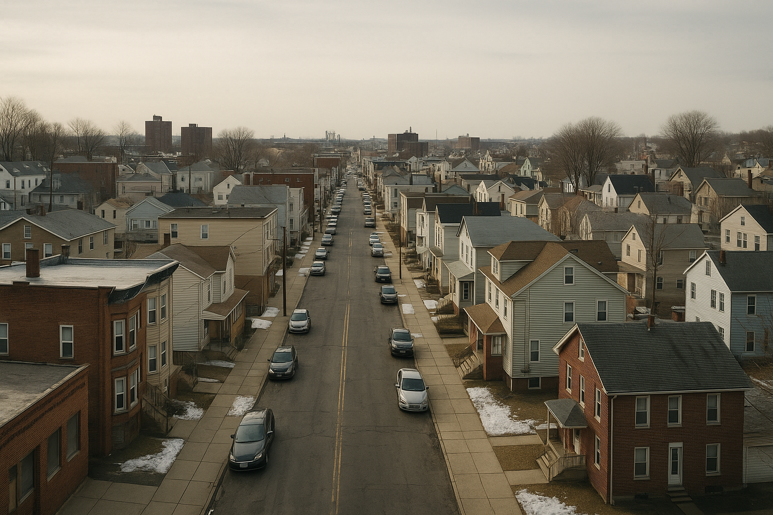
East Newark is 0.10 square miles of land -- New Jersey's 2nd smallest municipality -- established in 1895 when residents along the Passaic River bank petitioned to form their own borough separate from the larger Kearny and Harrison communities around them. At 16 feet elevation on the Passaic River's western Hudson County bank, East Newark looks across the river at Newark's Ironbound District. 2,594 people live in the borough at a density of 25,301 per square mile. The housing stock is predominantly 2-family and multi-family pre-war structures -- 21.4% built before 1940. The Harrison PATH station is approximately 5 minutes away, providing practical Manhattan access without the new-development pricing that Harrison's waterfront redevelopment has introduced. Newark Liberty Airport is approximately 10-15 minutes south. The Passaic River waterfront is the eastern edge. Niche rates the public schools "highly rated." The 29% homeownership rate (up from 25.6% the prior year) reflects a community where owner-occupancy is growing. East Newark is a small, specific, West Hudson community -- 0.10 square miles that has maintained its own municipal government since 1895 and intends to continue doing so.

Get In Touch

};